6. Site plan analysis
Site plan analysis
to realize my plan I had to choose a place where all the criterias needed are available ( Seaview, countryside, nature in general), I decided to choose Jijel, which is a town and roadstead port, northeastern Algeria, on the Mediterranean seacoast.
the following pictures show the exact location of where i decided it the perfect area for The Healing house in different layers
satellite :
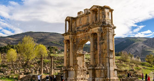
Algeria is known by a wide range of historical influences that became a unique interaction between former civilizations.
The Numidians’ age:
the presence of the Phoenicians and Carthaginians,
the antiquity of the Romans and Byzantines, and Spanish too:
the dominance of Islamic dynasties:
the Turkish invasion:
soil typology
The studied soil was extracted from a potential construction
site in the new city of Herraten, nearby Jijel town in northern Algeria. The
studied area and generally Jjjel region are characterized by a humid climate,
significant precipitation, and an important hydrographic network. The
geological studies indicate that the studied area is located in the Jijel
basin.
In Algeria, Jijel, Jijel, you can find Common fig, Olive,
Mastic tree, Wine grape, Common coleus, and more! There are 20 types of plants
in total. Be sure to look out for these common plants when you’re walking on
the streets, in parks, or public gardens.
There are 17 major watersheds in Algeria. Low rainfall means
that the majority of rivers in the mountainous and desert regions of Algeria
are ephemeral, flowing only after large rainfall events. Only the rivers in the
northern coastal region are perennial, flowing all year round. In the south,
wadis (ephemeral rivers) drain to closed internal sinks - chotts or sebhkas -
which are subject to high evaporation rates.
The Chelif (or Cheliff) River is the longest river in Algeria, flowing for 700 km from its source in the Saharan Atlas to its discharge point in the Mediterranean Sea.
The Agence Nationale des Ressources Hydrauliques (ANRH) is
responsible for river-flow gauging in Algeria. ANRH maintains a network of 162
hydrometric stations, almost exclusively in the north of the country, and
collects hydrometric data on average monthly flow rates or average monthly
inflows to hydrological stations. These data are typically available for
periods of between 25 and 30 years


-image-Algerie-Alger-as_173027350.jpg)


Unfinished work that needs completing.
ReplyDeleteYou have not created the finished design board. The objective was to complete this research, and then create a final design board.
Use a spell checker with all your work, there are many punctuation mistakes. You need to add Grammarly to your laptop or use the spell checker in Word.
There are no references included in your blog